Solutions that Redefines Navigation with Digitalization and AI-Powered Technologies
Built for Navigators, By Navigators
What is SafeNav?SafeNav continuously fuses sensor data, applies our COLREG algorithms, and provides real-time guidance on the next course and speed needed to avoid collisions and groundings, and how to return safely to the intended route or mission path. It is designed as a human-in-the-loop Co-Pilot first, and as the operational foundation for supervised autonomy later.
Safety & AssuranceBuilt for trust: SafeNav’s approach is grounded in DNV Approval in Principle, explainable maneuver logic, documented recommendations, and clear human oversight. The platform is being built to support assurance and certification maturity step by step rather than making unsafe leaps toward autonomy.
Core Platform Technologies
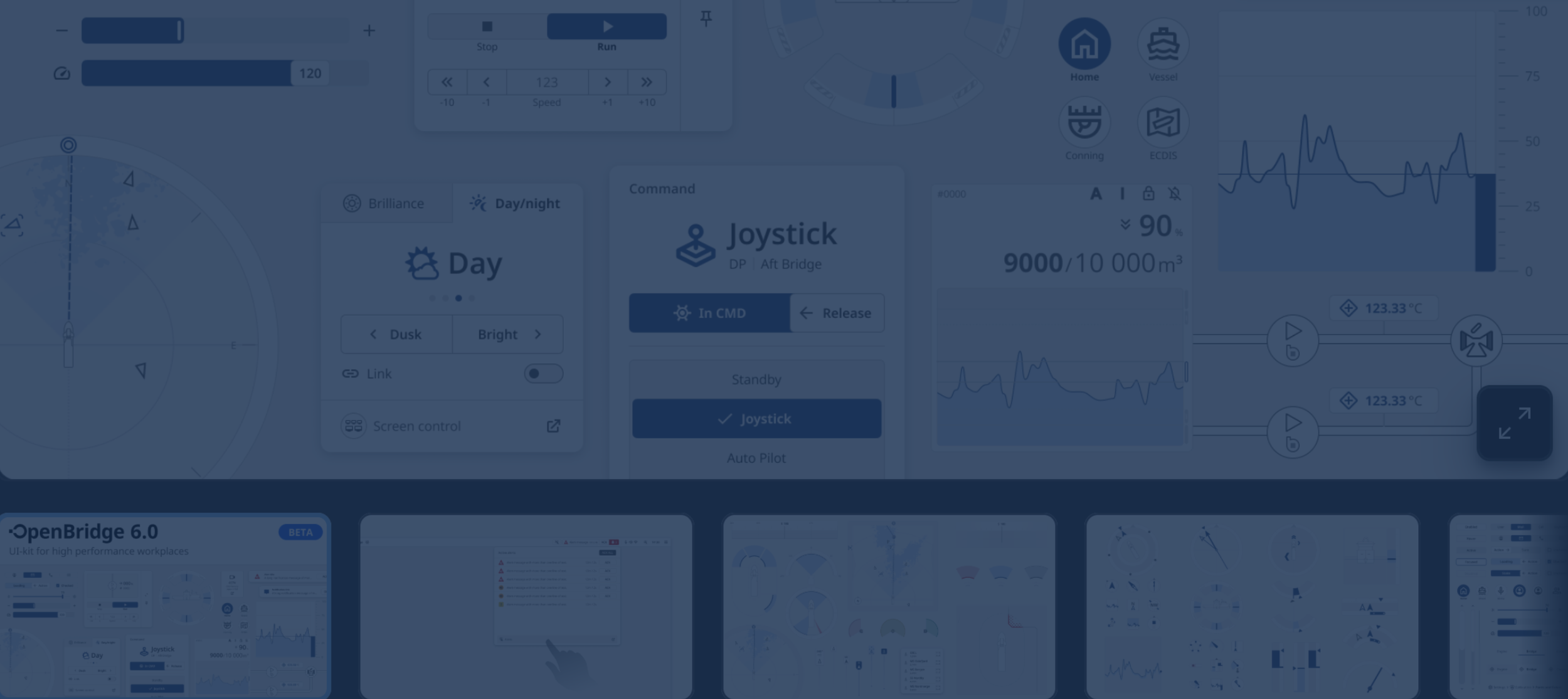
Decision Support System (DSS)
- Digital Co-Pilot
Real manoeuvring intelligence, not just more alerts.
With COLREG-compliant suggestions on how to avoid collisions, the SafeNav Co-Pilot (Decision Support System) is a critical component of the SafeNav system, responsible for generating alternative routes to avoid collisions with obstacles identified by the situational awareness system.
The DSS module consists of three main components: a COLREG (Collision Regulations / Convention on the International Regulations for Preventing Collisions at Sea) Classification Module, a Mathematical Obstacle Avoidance Model, and a Path Planning Module. Currently we are going for 34 out of 40 COLREGs, and fully compliant with all regulations.

Data & HSEQ Layer
- Ocean Observations Database (OOD) & Map
“Google Maps of the Sea”
Data collection and sharing of all kinds of hazards across systems (metocean data, extreme weather avoidance, singular events logged from other ships & in situ weather from local sensors). This runs through the Co-Pilot algorithms for well informed & data-backed suggestions.
Every advisory, near-miss, operator action, sensor conflict and confidence event is logged into the database and HSEQ dataset. That creates value for safety culture, replay, training, insurer dialogue, incident investigation, and long-term autonomy training.

Risk Module & Assessment
Currently taking into consideration historical accidents data, and in future also all external and internal factors like speed, rate of turn, current, wind, wave height, depth, traffic etc.
The risk assessment has a measured risk number for probability, the impact/outcome if that risk happens, the residual risk, and then advice on how to mitigate the risk level. Manning level can also be predicted with this module.
Data Fusion Module
Combines all incoming sensor data together (Lidar/Ladar, visual/thermal cameras, and ship radar), enabling the real-time display of full situational awareness of the maritime environment, on the bridge in a unified, clear and intuitive manner, all in one point of access.
The module uses advanced algorithms, including deep learning and probabilistic reasoning, to process data from the Lidar/Ladar and camera sensors. For the ship radar, decision-level fusion is used. The module is trained using VR (Virtual Reality) simulations and data augmentation, and its performance is assessed through rigorous testing.
A bridge simulator environment is used to gather early user feedback.
Route/Voyage Optimization
Contributes to Decarbonization
With current functionality to upload optimised routes, view other ship routes via Route Exchange, an API integration for new fuels coming soon, and the IMO’s future goals in mind.
The International Maritime Organization's (IMO) 2030 and 2050 goals are to reduce greenhouse gas (GHG) emissions from international shipping by 20% and 70% respectively, relative to 2008 levels. The IMO also aims to reach net-zero GHG emissions by 2050.
We aim to partner with Voyage/Route Optimization providers in order to integrate even more route optimization capabilities straight into SafeNav.
Interface & Testing